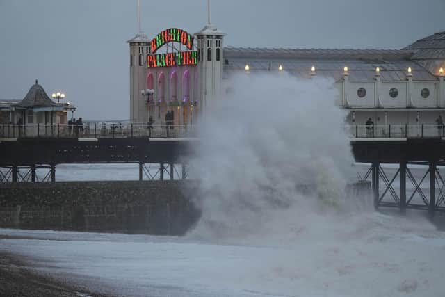
Flooding is 'expected' in these Sussex areas amid heavy rainfall; multiple alerts in Surrey
and live on Freeview channel 276
As many as 284 flood warnings have been issued by the UK Government’s Environment Agency. This means that ‘flooding is expected’.
These are the Sussex areas affected by these warnings:
– South Downs National Park (Tilmore Brook through central Petersfield; Stanbridge Stream at South Petersfield; Lodsbridge to Shopham Bridge on the Western Rother; Fittleworth on the Western Rother).

Advertisement
Hide AdAdvertisement
Hide Ad– Horsham district (Broadbridge Heath to Pallingham Quay on the River Arun).
– Arun district (Bersted on the Aldingbourne Rife)
– Mid Sussex (Mock Bridge, near Shermanbury on the River Adur; Lindfield Bridge; Freshfield Bridge to Sharpsbridge).
– Lewes (Barcombe Mills);
– Hailsham (Hellingly and Horsebridge);
These are the Surrey areas affected by these warnings:
– Godalming (River Wey at Elstead and Eashing);
– River Mole at Dorking and Mickleham;
– Hoe Stream at Woking;
– River Wey at Old Woking;
Flood alerts, meaning ‘flooding is possible’, have been issued for 312 UK rivers – including these Sussex hotspots:
– Chichester (West Dean, Singleton, Charlton, East Dean and Chilgrove & the River Lavant);
– Arun district (Aldingbourne and Barnham Rifes);
– South Downs National Park (Lower Arun);
Advertisement
Hide AdAdvertisement
Hide Ad– Crawley / Horley (Upper River Mole, Ifield Brook, Gatwick Stream and Burstow Stream);
– Horsham district (Upper Arun; River Lox);
– Mid Sussex (River Adur East Branch; Upper Ouse)
– Forest Row (Upper River Medway);
– Brighton (Groundwater flooding in Patcham);
– Polegate (Cuckmere River & Langney Haven);
– Rye (Rivers Tillingham and Brede);
– Bexhill (Combe Haven)
Flood alerts in Surrey:
– Redhill Brook at Redhill and Salfords Stream at Salfords;
– River Mole and its tributaries from Kinnersley Manor to South Hersham;
– Lower River Wey;
– Upper River Wey;
– Windle Brook and Hale, Mill and Addlestone Bournes;
– Cranleigh Waters;
– River Thames from Datchet to Shepperton Green;
– River Thames from Shepperton to Molesey;
– River Thames at Thames Ditton Island;
– Chertsey Bourne
Road closures are still in place following heavy rainfall this week. Click here to see the areas you should avoid in Sussex.
Advertisement
Hide AdAdvertisement
Hide AdA yellow rain warning had been issued by the Met Office on Thursday and expired at 3am today.
A Sussex Police statement on social media read: “Storm Henk will continue to cause disruption into Friday. The heaviest rain is expected across West Sussex.
“Care should be taken when travelling. Expect lots of surface water and spray. Slow your speed. Leave plenty of space between vehicles. Avoid driving through floodwater. Ensure vehicle lights are in working order.”
The Met Office said the cloudy weather early on today, with some outbreaks of rain, will gradually ease.
Advertisement
Hide AdAdvertisement
Hide Ad“An improving picture with variable amounts of cloud and brighter spells developing in the afternoon,” a weather forecast for the South East read.
"Perhaps a few light showers in the west. Temperatures near average. Breezy at first. Maximum temperature 8 °C.”
The forecast for Saturday read: “Largely dry with variable cloud and bright or sunny spells, especially in the west. Chance of a few light showers, mainly affecting coastal districts. Breezy and feeling colder. Maximum temperature 6 °C.”
And the outlook for Sunday to Tuesday read: “Largely dry with variable cloud and bright or sunny spells throughout. Perhaps a few coastal wintry showers possible. Feeling much colder, with a brisk easterly wind. Patchy frost by night.”