Crossroads forms gateway to the park


He writes. We have seen that the railway embankment erected in 1850 cut the Priory Valley in half with land on either side being sold for development, 149 acres of the St Helens Estate being sold in the 1860’s and populated with middle-class housing in various phases. Alexandra Park had evolved from St Andrews Gardens after being laid out in 1878 by renowned landscape gardener Robert Marnock and formally opened by the Prince and Princess of Wales in 1882.
North of this barrier Queens Road ends at the crossroads with St Helens Road that runs alongside the Park, Braybrooke Road that runs parallel to the railway to Cambridge Road, after passing under the railway at Braybrooke Terrace with the first few houses on Braybrooke Road appearing there at the end in the early 1880’s. The Queens Road end of the road is now Bethune Way and is opposite Elphinstone Road that was formerly part of Ore Lane heading up to The Ridge.
Advertisement
Hide AdAdvertisement
Hide AdAll illustrations throughout this series are from Ion Castro’s own collection and he took the ‘modern’ colour pictures himself. Ion can make available copies of many of the historic images used in this series - contact him - [email protected] or tel: 01424 437468 and there’s more local history on Ion’s website, www.historichastings.co.uk.
Captions:
Braybrooke Road.
This image by an unknown photographer dates from the 1950’s and shows the old Hastings Grammar School in the upper centre and Hollingsworths Motor Repair shops on the right. Today the terrace of tall Victorian houses on the right ends at No 132 but in the early 1970’s the houses on that side of the road included a pair of semis, nos 134 and 136 built in the same style as the rest of the terrace and a fine Edwardian villa, no 138, once occupied by Henry Ward the prolific Hastings architect whose achievements included Hastings Town Hall, Debenhams, the Observer Building in Cambridge Road, Bexhill Town Hall and many, many churches. In the early 1970’s No 138 was acquired by Hollingsworths and was demolished to extend their car park; Nos 134 and 136 followed shortly after.
Hollingsworths.
Hollingsworths in 1999, demolition has already started on the Rapid Fit concession on the right. The ‘Ford parts and service’ sign is still there today
Hollingsworths 1.
An early 1950’s view down Braybrooke Road toward the railway showing Hollingsworths on the right and Hastings Grammar School above it.
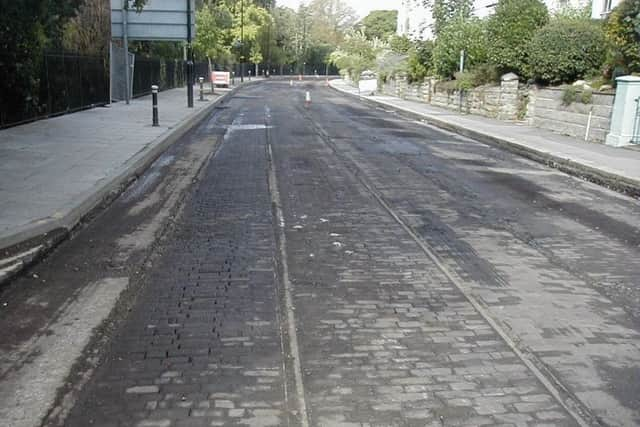
Tramtrack.
Advertisement
Hide AdAdvertisement
Hide AdResurfacing St Helens Road in 2000 meant the removal of the top surface and this revealed the woodblock surface and double tram track last seen in the early 1930’s before being covered in tarmac. Woodblock was used in better class areas and near hospitals because it was quieter under horses hooves than the granite block surfaces used elsewhere.
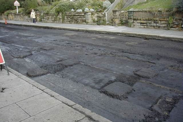
Barrier.
During 2000 the road surfacing of St Helens Road from the Park Gates to Spa Hill was removed for renewal and revealed the original woodblock and tramlines laid in 1904 prior to the opening of the tramways in 1905 and buried since the 1930’s. The removal of the surface also revealed the stumps of the wooden baulks that would have formed a barrier during the second world war and probably removed in 1944.
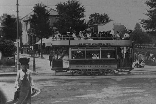
Elphinstone Road Hastings.
A view taken from the bridge showing a tram passing the bottom of Elphinstone Road which was too steep for trams so they had to run via St Helens Park Road and Laton Road. Apart from the tram the scene is little different 110 years later. Note the spire of Mount Pleasant Church, demolished in 1972, on the right.
St Helens Rd.
This image from the first decade of the last century shows Saxonhurst on the left, virtually unchanged but part the garden has been sacrificed for the roundabout and bus stop.
Entrance to Alexandra Park St Helens Road.
Advertisement
Hide AdAdvertisement
Hide AdThis panoramic picture of the Park Gates dates from around 1910 and a horse van from The London Confectionery Company, 13 South Terrace, can be seen on the left with the horse drinking from the horse trough which would have seen a lot of use from the horses that pulled the horse buses up Elphinstone Road to Mount Pleasant Road.
Entrance to Alexandra Park 516.
A fine view of Saxonhurst, its garden and statuary in around 1910, the garden has since been cut away to accommodate the roundabout and a bus stop.
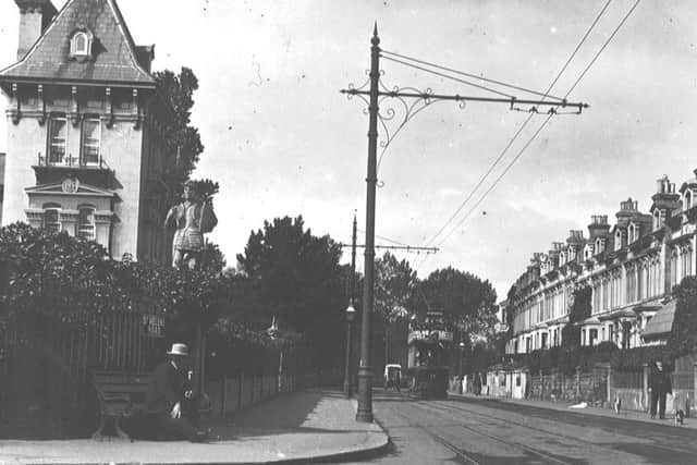
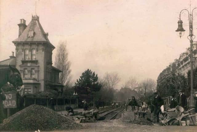
St Helens Rd Hastings Tramways.
Laying the tram track in 1904 ready for opening the system in 1905. Most of the permanent way was single track with passing loops but St.Helens Road was double from the bridge to Spa Hill (St.Helens Park Road) This section of track was exposed in 2000 when the road was resurfaced. The horse on the left may have been attached to a bus waiting to ascend Elphinstone Road or a ‘cock horse’ that was added to assist pulling the bus up steep hills and would then return to await assisting the next bus but his days were numbered with the advent of motor buses and the trams.